SJE is specialized in solving problems in and around flowing waters. To analyse and solve the problems the self-developed software is used, taking into account the relevant technical and ecological aspects. The range of services is focussed in particular to the following scientific fields:

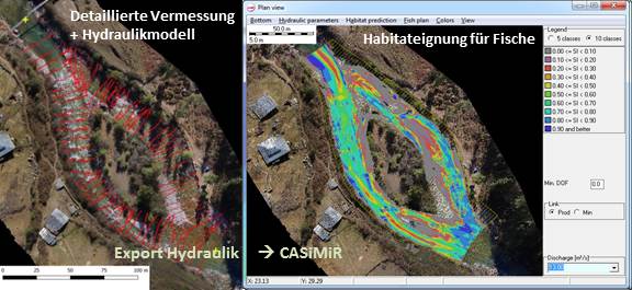
River modeling
- Extended experiences in river hydraulics and hydrodynamic numeric modeling (HN-modeling)
- Water level calculations and hydraulic dimensioning of hydraulic-engineering installations
- 1D, 2D and 3D models to assess flow properties in the range from low to high flow (flood) situations
- Software: CCHE, HYDRO_AS-2D, MIKE 21, HEC-RAS, SRH-2D, Delft3D, BASEMENT, FESWMS, River2D, FLUMEN
|
|

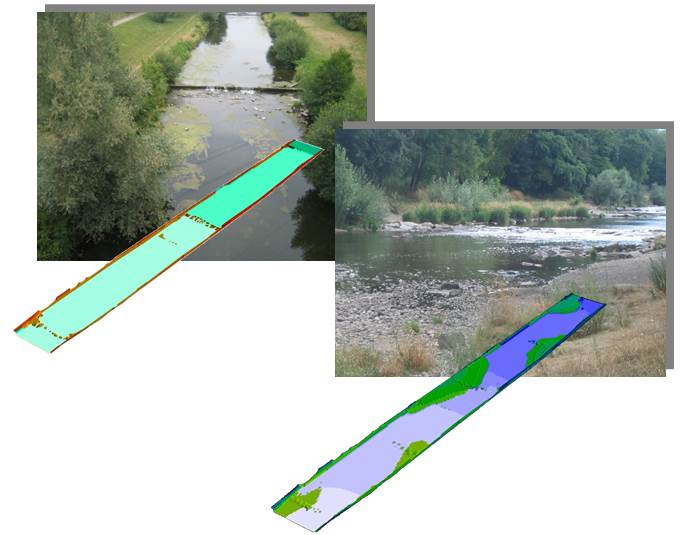
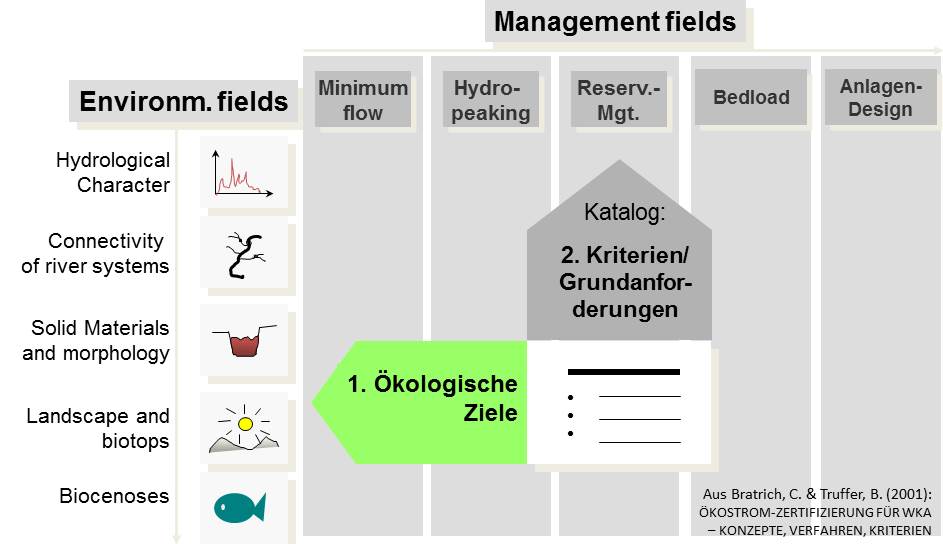
Ecohydraulic/habitat modeling
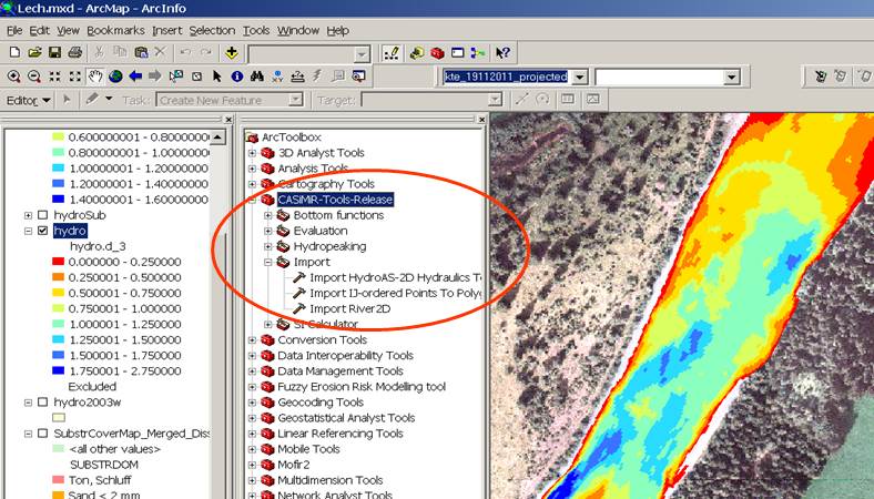
- Analysis with model system CASiMiR (www.casimir-software.com)
- Investigation of flow regulations, environmental flow, river enginering measures, river restoration, operation of hydraulic-engineering installations, impacts of hydropeaking, etc.
|
|

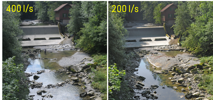
Evaluation and analysis of ecologically based runoff control/hydropeaking
- Quantitative evaluation of the dependence of aquatic habitats on varying discharges during relevant time periods
- Model-based elaboration of structural and hydraulic measures aimed on reduction of negativ effects of hydropeaking
- Application of the model system CASiMiR
|
|

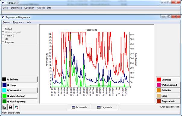
Efficiency assessment of hydropower plants
- Assessment of hydropower energy production for different technical solutions or discharge regulation schemes with the software CASiMiR Hydropower
- Ecological and economical optimization of hydropower plants
|
|

Environmental impact assessment of hydropower plants
- Environmental impact assessment for hydropower plants in cooperation with aquatic ecologists and fish experts
- Application of "Greenhydro" procedure of the Swiss EAWAG (developed in cooperation with SJE)
- Comparison of ecological and economic effects of different operation modes or structural enhancement measures
|
|

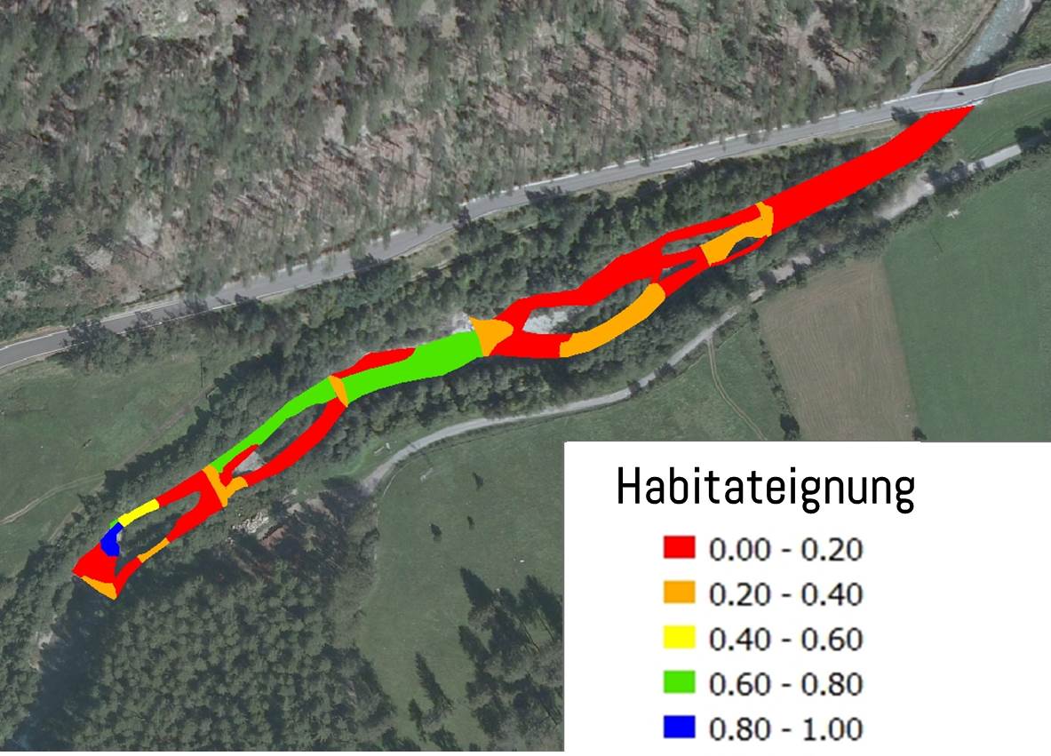
Meso-scale analysis of river systems
- Application and development of the model system MesoCASiMiR for assessment of habitat quality and availability in the aquatic, semiterrestric and terrestric zones of river systems. Analysis of the ecological status according to WFD
- Model-based analysis of effectiveness of reconstruction and restoration measures
|
|

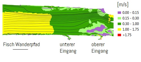
Investigations of upstream and downstream migration of fish
- Application and development of the agent-based approach within the software CASiMiR. Assessment of river stretches and fish passes in terms of their passability and attraction flow. Virtual fish-agents can be supplied with different behavior properties
- Analysis of the interactions between fish and flow with innovative fish-shaped sensors (project Fishview)
- Investigations of migratory fish behavior using telemetry and GIS
- Investigations of fish pass facilities in terms of hydraulic functionality (upstream and downstream)
|
|

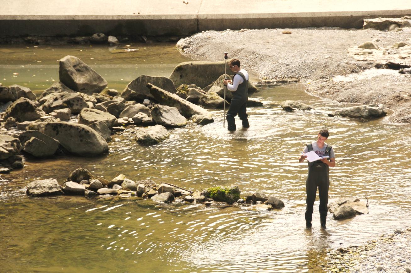
Survey and mapping
- High resolution river survey (banks and underwater zones)
- Mapping of morphological and habitat relevant river characteristics (e.g. structural quality of rivers)
- Evaluation of results and GIS-based data processing
- Photogrammetric survey of complex river morphologies using drones and Structure from Motion (SfM) technology → HyDroneS (www.hydrones.de) in cooperation with I AM HYDRO GmbH
|
|

Model development and applied research
- Development of the model system CASiMiR in cooperation with the Institute for Modelling Hydraulic and Environmental Systems (IWS) of the University of Stuttgart
- Close collaboration with many universities and participation in numerous applied research projects, for example: RIVERTWIN, ALPRESERV, FISHVIEW, KLIMOPASS, FITHYDRO, RETERO, RIBES etc. Member of the European Aquatic Modeling Network, regular participation in international trade fairs and conferences
- Development of GIS tools for habitat modelling, river mapping and data processing
|
|

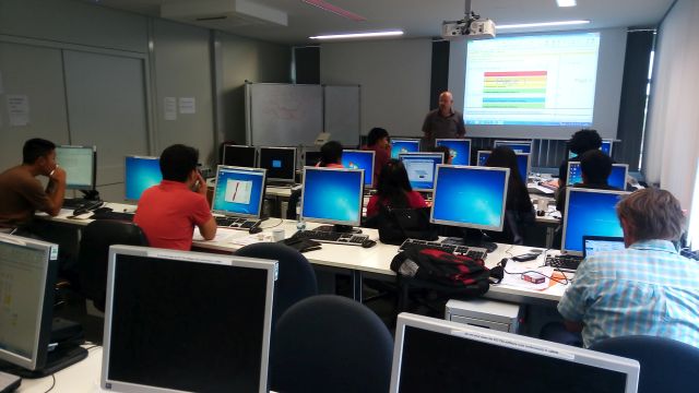
Training and education/CASiMiR courses
- CASiMiR model traning courses
- Hydraulic and terrain modeling courses
- Seminars, teaching the basics of habitat modeling, development and application of fuzzy-logic and preference curves
- Practical courses for application of habitat models and other modelling techniques in case studies
- Hints for relevant input parameters and required field survey efforts as a prerequisite for model application
|
|